After our challenging but satisfying climb of peak Yelmo, we slept in the natural park that night.
We believe that the challenge of today’s trek is not in the navigation but in the length. The trek is meant to be 30 kilometres long. As the days are shorter we are looking to shorten the trek so that we can keep it within daylight and ensuring a comfortable pace.
We have estimated that the shortened loop around the horseshoe will take around eight hours. This means that if we start at 8.00 am, we should be finishing by 17.00, including an hour for lunch. Still quite tight as this would only give us one hour day-light contingency. But we understand the route is fairly well-marked and there won’t be challenging climbs which could potentially slow us down.
We get up at 7.00 am, it is still dark, but we need to get ready beforehand to enable us to start the trek as soon as it gets a bit lighter. We look at the map again, we have estimated that at 3 kilometres per hour in constant ascent, we should be at the top at 13.00. If we are later we will need to take a shortcut. This will mean, backtracking for another hour and taking a route straight down to the valley. We hope we won’t need to do that. The aim is always to complete the route, besides, the route down the valley won’t be that spectacular.
Time to go, the day is gradually brightening up, there are no clouds in the sky. It looks like the weather will grant us with another clear day.
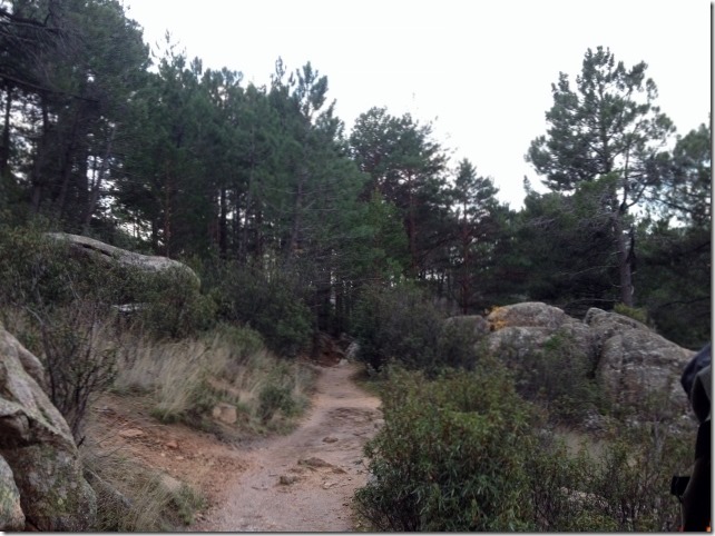
To start with, the path takes us through pine trees. It is well-paved and relatively flat. The combined smell of humid earth and fresh pine tress invade our nostrils.
We are chatting quite lively. A bit weird from my side. It normally takes me a good couple of hours after a coffee to become social.
Social! Normally she is like a bear with a sore head until well after lunch, very dangerous to even think of striking up a conversation. Best to keep quiet. I am quite concerned about all this early morning banter, something must be wrong. ![]() GDR
GDR
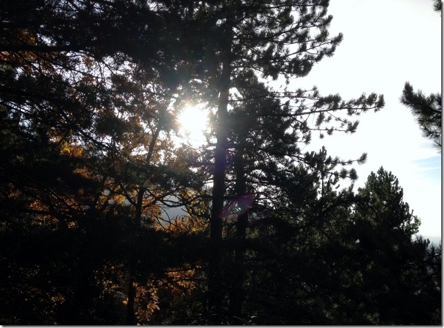
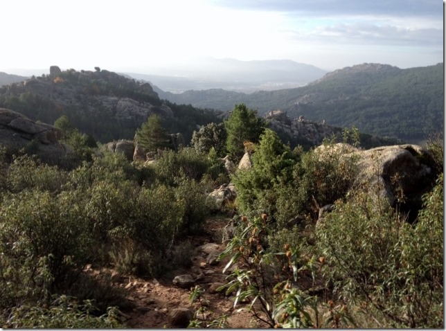
It is only 9.00 am and already warm. Soon we will need to stop to get rid of a few layers. Maybe after this corner, where the landscape seems to open up from the woods. The light through the trees deserves a painting.
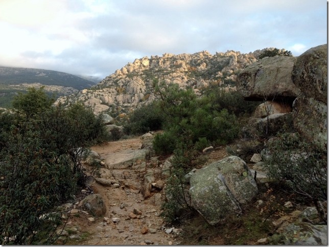
The path is lovely. It has a combination of different terrains: flat and paved to start with, then rocky, rugged and steep and then back to flat and smooth again. The variation of the path makes the walk more interesting and forces us to constantly change our body position so it prevents us from getting tired. There is nothing more exhausting and frustrating that a relentless trek.
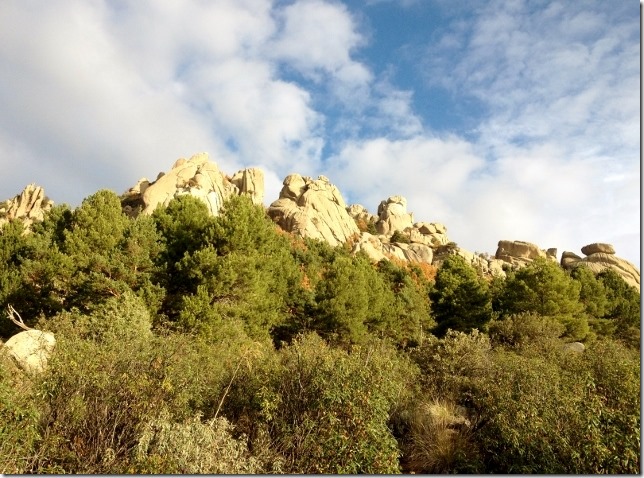
However, this fun won’t last forever. We start to see what is ahead, the actual ascent to the top over big boulders. Maybe we should forget our poles and start using our hands and feet with care and balance. I suspect this ascent will start soon as the path is becoming steeper and steeper since we left the woods.
Although it looks close, we believe it is still around 45 minutes away.
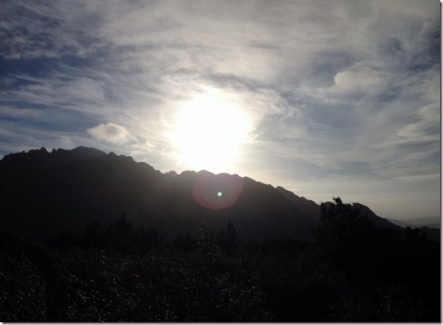
We look back. The sunlight is particularly beautiful. We hope it keeps like this when we get to the top. It will be another amazing view.
We have gained hieight pretty quickly, around 400 metres in one and a half hour. The path has been easy to follow, we are so enjoying the start of the scramble to the top.
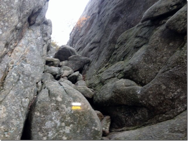
The rocks are granite which offer good grip to the boot. In summer conditions you won’t need to use your hands to go up on 45 degrees slabs. However, at this time of the year, the rocks are wet and slippery.
On big boulders, I am at a disadvantage to Gary. I have shorter legs and arms which makes it more difficult to reach hand and foot holds. Most of the time, I can get away with finding my own route by going around the boulders. Other times, Gary has to help. I hope we won’t find too many of these.
Half an hour of scrambling and everything is going well, good pace and no problems on the rocks. Yellow and white marks proves we are following the right path.
We are now crossing the ridge. This would mean that, from now on, we will walk on the north side of the ridge which is wetter and colder. The scramble might turn out to be more challenging.
We were right. Gary is ahead of me. Suddenly, he gets stuck in between two big rocks. “I am not liking this” he says. “I cannot find a hand hold to lift myself up, it is too slippery”. I cannot do a great deal from where I am. I am not very stable myself, I am standing on two small foot holds.
In situations like this, quick and decisive moves are needed. The longer you stay in that position, the more tired you get and the less likely to get yourself out of it. He eventually goes up and helps me out. I have also to use my knees to reach the small hand holds he used. Would the path be all the way like this? I am worried. It would take a long time.
No, to our relief. The rocks along the ridge became slightly flatter. We stop briefly to assess where we are. Looking at the map, we estimate we will be at the top in about an hour. We are half an hour ahead of our planned schedule.
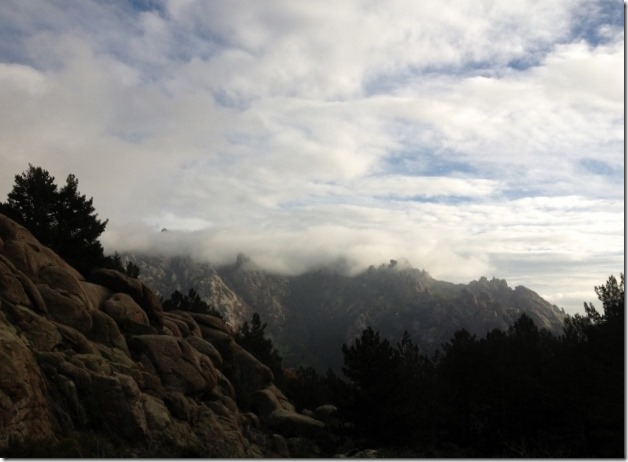
In the distance, clouds are building up. Not to worry, that is not our peak.
One hour later, we reach the top. We are now at an altitude of 1,800 metres. It is 12.30, half an hour early than expected. Good news, although we shouldn’t slow down on the descent, still a long way to go.
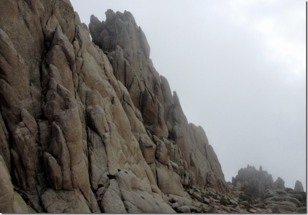
The peaks surrounding the summits look spectacular. Shame we didn’t bring the ropes, we could have practised a bit of more technical climbing.
Here, we stop for lunch. Empanada gallega de atun (sort of fish pie) and galletas del principe (chocolate biscuits which I used to love when I was a child).
We are seeing that the wind has changed and the clouds are coming in our direction.
Suddenly, a Spanish climber turns up going to the opposite direction as us. Again, on his own. These people are absolutely mad.
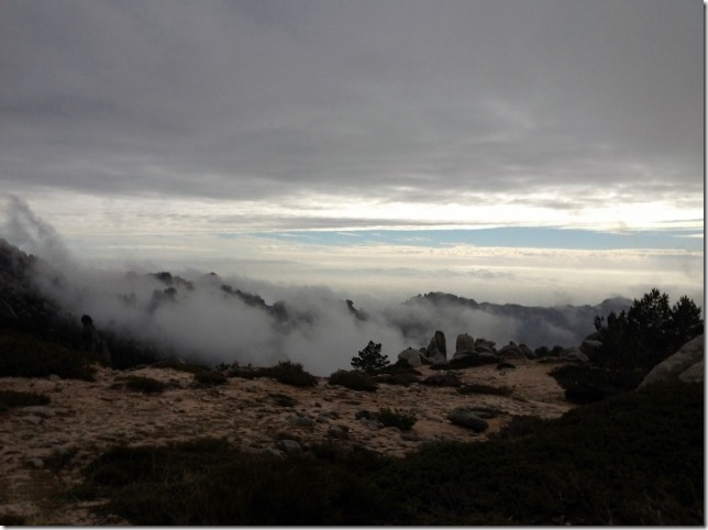
We look to the distance. The clouds are moving up the valley. This is not good. Poor visibility might create problems in finding the route, even if it is well-marked. We need to press on.
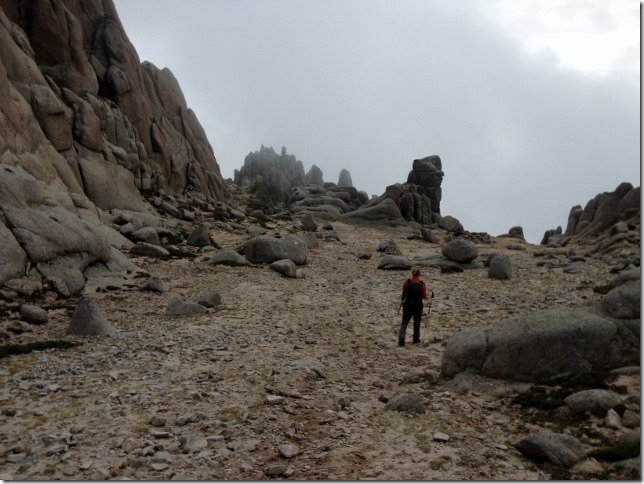
The cloud is getting thicker, luckily the route marks are fresh and bright. The sooner we lose height the better.
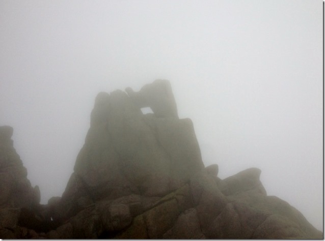
The look of the fog is still beautiful and mysterious.
We start walking slower to avoid losing the marks. As soon as we go down, the marks start to fade. Very strange. So far, they have been so obvious. It has to be this way. The book clearly says that the route follows these yellow and white marks all the way down.
The path is becoming flatter, the rocks gradually disappear. We continue to lose height. This is a good sign.
Suddenly, the marks have disappeared. However, we are on an very obvious path, lets keep on for a bit to see if we find them. They may have been more spread out for all we know. This was our first mistake. We cannot find any marks. Lets go back to the place we saw the last one. In the meantime, we have lost 45 minutes in the process.
We are backtracking our steps. In such a thick fog, the path doesn’t look familiar. Gary suddenly exclaimed “A mark!”. Such a relief, lets follow it. This is better than nothing.
This doesn’t look right. We are going up. The path is taking us to the top of a ridge. Lets go up there anyway and have another good look at the map.
Suddenly we were surrounded by a rock labyrinth. We look at the compass. We are walking north east when we should be going south west. Where the hell are we??
We hear a strong noise in the distance. I say “thunderstorm”, Gary exclaims “A plane”. We both hope he is right.
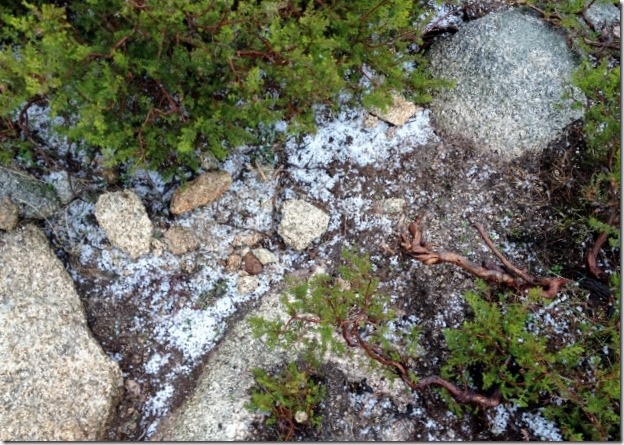
He wasn’t. Thunderstorms can be lethal in the mountains. It now starts to hale. We are bombarded by very painful pea sized pieces of ice. Quickly, we take out our waterproof jackets.
It has only lasted for five minutes. The sun comes up again. Good, lets press on whilst it is clear. The amount of hale discharged in such a short amount of time is amazing!
Before we continue, we look at the altimeter. How is it possible we are back up at 1,700 metres? The thunder is back. It doesn’t look good. We need to get off of this mountain as soon as possible, although we may not be walking in the right direction.
It now starts to rain. We are getting quite wet. We look at the time, it is 16.00 we have only two hours of day-light. We look at the altimeter, we are now at 1,400. We continue to walk north east but at least we are loosing height.
Suddenly, we see a valley in the distance. Is that our valley? The compass indicates south. This means we may be in the wrong valley. I wonder where we will end up.
The rain continues, so should we.
We are getting quite scared that it may get dark and we are still not sure where we are. Will we be spending the night on the mountain?
We are now walking next to a stream, through bushes and spiky plants. This is slowing us down and it is becoming quite painful. We are becoming to look like an image of Jesus Christ, I have scratches across both hands and Gary across his forehead!. We are better off walking along the stream. The downside, we will get quite wet and it is more slippery but at least we will get less scratched and we are losing more height.
We must be quite low now. I look left and I see a big lake in the distance. This must be the lake close to Manzanares el Real, the village at the head of the valley. I shout at Gary with joy. “Gary, civilization!!”
Now we know where we are, yes, in the wrong place. But this means that we are close to people and we won’t be spending the night in the mountain. All we need to do is head towards that lake, walk to the village and get a taxi back to Dora. This could be a good couple of hours away and it is already 17.00. We will be walking back in the dark but as long as we reach a decent descent track we will be okay. We always carry torches with us just in case, this will be only the second time they have been necessary, the other being up to Angel Orus.
Eventually we leave the stream and pick up a path. Hopefully this will eventually take us to our lake. The path gradually becomes wider and wider. Such a relief. It is now that we realise how cold and wet we are. The adrenalin has kept us going up until now. We are relieved though. The day will have a happy end after all.
We are now on a 4×4 road and we are starting to see houses. It is pretty dark but we don’t need to use our torches with the light from the houses.
We eventually reach the main road to the village, we try to hitchhike. Luckily a car going towards the village stops. He looks scared, goodness, I wonder how we look! He asks us if we are all right and thereafter, starting to tell us off, “You shouldn’t be going up there at this time of the year! The Pedriza is too dangerous”. It seems I am listening to my father.
He has dropped us at the taxi stop and we get a taxi back to Dora. We are so happy, we thought we might never see her again!. We also now realise how knackered we are.
We put the heating on and have a nice shower, we need it.
For dinner, we have some soup for starters to warm us up. We have looked at each other. Is it worth it? We both agree that it is. In these situations, you learn a lot about yourself and others. We both coped well and continuously interacted with each other, keeping a fast pace, doing our best in assessing where we were and made quick, but more importantly, the right decisions.
On the other hand,we need to review where we have made mistakes to prevent them from happening again.
SM & GDR


Tenías razón , el miedo me ha sobrecogido antes de tiempo,.
Creo que la experiencia es un grado, pienso que con ella y la sensatez lograreis, los objetivos marcados.
Suerte en vuestras nuevas aventuras.
Esa es la historia. Creo que somos bastante sensatos. Todo tiene sus riesgos, y somos conscientes. Lo importante es hacer lo que a uno le gusta y saber a que se expone